LOUIS EDITION
Vigtige henvisninger
LOUIS EDITION
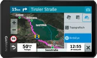
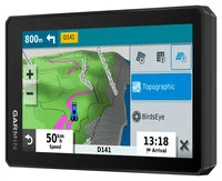
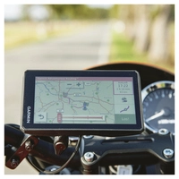
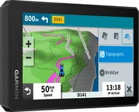
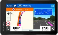
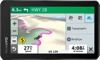
Where should the motorcycle tour go this time? Well, if you don’t know, the All-Terrain Navigation System flagship Garmin Zumo XT Louis Edition will make suggestions. Whether it’s in the middle of nowhere, the urban jungle, or wide open spaces, the Zumo XT Louis Edition reliably guides you to your destination. Various programs, pre-installed maps for Central Europe including updates, topographic maps, motorcycle points of interest (POIs), and a feature-rich design leave no wishes unfulfilled.
Ultra-bright display:
The 5.5-inch (14 cm) HD touch display has an enormous brightness of ~1,000 cd/m². It can be used in portrait or landscape mode, operated with gloves, and is rain-resistant thanks to IPX7.
On- and off-road navigation maps:
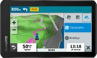
Turn-by-turn navigation with audio prompts, topographic maps for off-road navigation, and BirdsEye satellite images. Includes updates via integrated Wi-Fi.
BirdsEye Direct:
BirdsEye satellite images can be downloaded directly to the device via Wi-Fi for selected areas and in various resolutions, allowing offline use without a subscription.
Explore App:
Pre-installed POIs from TripAdvisor® with ratings, Foursquare® POIs with check-in functionality, motorcycle POIs, and iOverlander POIs with off-road destinations and information.
Track Recorder:
Record and save routes on the device for future adventures or share them with others.
Easy route sharing:
Share routes in GPX format directly between two Zumo devices, via the Garmin Drive app on your smartphone, or using a memory card.
Garmin Adventurous Routing:
Increase the proportion of curves and mountains when calculating routes and round trips based on desired intensity.
Music player:
Stream and control music from your smartphone directly on the Zumo XT Louis Edition display or play MP3 files from the internal storage.
Safety features:
Selectable driver assistance with alerts for special route features such as sharp curves, Bluetooth® hands-free function, and automatic accident notification based on event detection.
Live traffic, weather, and more:
Receive real-time traffic information, weather data, share routes with others, and receive notifications directly on the Zumo by pairing it with your smartphone and activating the Garmin Drive app.
Map coverage:
Street navigation maps for Central Europe (20 countries) including updates.
Navigation:
Pre-installed topographic maps for off-road navigation, BirdsEye satellite images via download, integrated Garmin Adventurous Routing, round trip planning, and TracBack function. Also includes TripAdvisor®, Foursquare®, iOverlander, and motorcycle POIs.
Multimedia/Bluetooth:
Live weather, live traffic, and more via the Garmin Drive app. Bluetooth® hands-free function and integrated music player. Integrated track recorder with compass and altitude profile. Compatible with the Garmin Explore app.
Technical information:
Dimensions: 148 x 86 x 24 mm
Weight: 271 g
Maximum storage capacity: 4 - 64 GB
Included in the package:
1 x Zumo XT
1 x Motorcycle mount with adapter plate
1 x Motorcycle power cable
1 x USB cable 4 x Cable ties
1 x Quick start guide
Central Europe coverage:
Andorra, Belgium, Denmark, Germany, France, Italy, Croatia, Liechtenstein, Luxembourg, Monaco, Netherlands, Austria, Poland, San Marino, Slovakia, Spain, Switzerland, Czech Republic, Hungary, Vatican City
Important note: The devices are shipped partially discharged or with low battery. If the device doesn’t start, it needs to be charged first using a USB charger (minimum 2A charging current).
registration number WEEE: NPWD 349771 Manufacturer: Garmin Deutschland GmbH | Parkring 35 | 85748 Garching | Deutschland | +49 89 541999-700 | vertrieb@garmin.de | www.garmin.com

Førende GPS-teknologi
Garmin er en globale markedsførende virksomhed inden for mobile navigationsenheder og en af de mest erfarne producenter inden for GPS-teknologi. Garmin har udviklet zumo-serien specielt til motorcykelførere: Disse GPS til motorcykler kan bogstaveligt talt betjenes med venstre hånd (og med handsker) og holder let stand mod snavs og fugt. Hvad der desuden er endnu vigtigere på motorcyklen er, at med Garmin zumo kan enhver tur let planlægges. Garmin-navigationsenheder viser på enhver måde vejen.

Bluetooth er en standard for dataoverførsel mellem forskellige enheder over en kort eller mellemlang afstand. Bluetooth danner en grænseflade, hvormed mobile enheder som mobiltelefoner, GPS'er eller kommunikationsenheder kan kommunikere med hinanden. Hovedformålet med Bluetooth er at overflødiggøre kabelforbindelser mellem enhederne.

Global Positioning System er et globalt navigationssatellitsystem til positionsbestemmelse og tidsmåling. GPS har etableret sig som den vigtigste lokaliseringsmetode og er for eksempel vidt udbredt i navigationssystemer.

Louis Edition-produkter - udviklet i samarbejde med Louis, designet nøjagtig efter dine ønsker og behov, produceret af velkendte producenter og kun tilgængelige hos os. Virkeligt eksklusive produkter. Holde øje med "Louis Edition"-mærket.
Og den overraskende gode pris.
For at sikre, at din faktuelle og sandfærdige erfaringsrapport er til stor gavn for alle læsere, bedes du overholde følgende regler.
- Bedøm kun produkter, som du personligt har brugt til det tilsigtede formål.
- Begrund venligst din positive og negative kritik. Dette er den eneste måde, andre kunder kan drage fordel af, og vi kan forbedre produktet, hvis det er nødvendigt.
- Undlad venligst at kopiere indhold, der allerede er blevet offentliggjort andre steder. Din personlige oplevelse tæller her.
- Databeskyttelse: Skriv ikke dine egne eller tredjepartsadresser, telefonnumre, URLsr eller navne på tredjeparter (personer eller virksomheder) i din anmeldelse.
- Sammenlign ikke din produktanmeldelse med produktsortimenter fra tredjeparter. Uanset om du anmelder dem positivt eller negativt, ville du eller vi som operatør af denne online shop overtræde konkurrenceloven.
Fairplay: Følg venligst disse regler, så vi ikke behøver at forkorte din anmeldelse eller slette den helt.
Din produktbedømmelse er blevet gemt. Den vil blive vist om et par minutter
Vil du virkelig slette din text?

